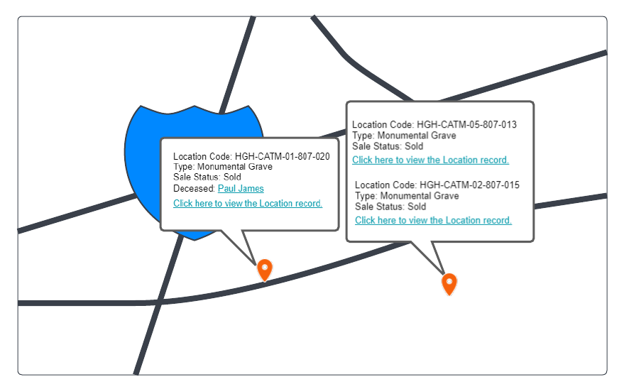
The Map Information features uses GPS co-ordinates to show the physical Location on an embedded geo-spatial map base in byondpro. This change shifts the base map technology from Google maps to Leaflet, to take advantage of improved functionality. All the existing rules for map usage will remain as is, with the addition of items 1) and 2) below.
Leaflet will apply for all map information tabs available in Site, Area and Location Records.
Leaflet will be deployed as the base map for integrated website and kiosk deceased search functions.
Map navigation should retain the existing functionality such as change map layers, zoom in/zoom out and full screen mode. Also it will display deceased names on zoom with aerial imagery overlays.
1) If the area on the map has multiple locations, when zoomed out, the area should have one pin.
1a) When the user zooms in, location pins can be populated to respective location.
1b) Single mouse click on the single pin with multiple location will show list of locations.
2) Map should show the number of results pinned on the map from the total result filtered from the entity.
2a) Number of results will be updated when the user navigate across the map/ Zoom in/ Zoom out.